I couldn’t get to all the stories I wanted to share in my last blog post so this is part two of this incredibly unique part of Oregon.
This segment and so much more is best heard and experienced on our GPS audio tour app of the Cascade Mountains between Salem, Eugene, and Bend.
Ok back to the pass… Are you ready? Let’s go take a mini-road trip!
Do you remember the story in my last post about Felix Scott and his attempts to build a road? As Scott’s road-building crew neared the lowest route across the mountains, they encountered miles of snow and jagged lava fields at McKenzie Pass. John Templeton Craig (one of Scott’s workers) favored chipping out a road through the lava fields, but Scott decided to skirt the lava fields using a notch at Scott’s Pass on the shoulder of North Sister that was 1,000 feet higher, steeper and with a thicker snow blanket. Scott’s route was later abandoned and is known today as the Scott Trail in the Three Sisters Wilderness.
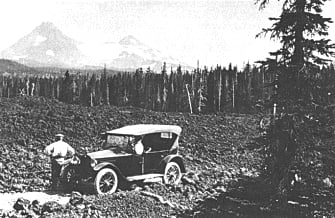
After working for Scott, Craig spent the next 15 years laboring and championing his vision of a lower crossing through the McKenzie Pass. In 1871 he formed the McKenzie, Salt Springs and Deschutes Wagon Road Company and began to build his toll road. He cut trees, chipped and chiseled a roadblock out of the jagged lava fields just north of North Sister to form a McKenzie Pass crossing lower than any other available at the time. By the fall of 1872 the new road opened and began collecting tolls of $2 for a wagon, $1 for a horseback rider, and 10¢ per cattle and 5¢ per sheep. After its completion, he secured a federal contract to deliver mail from the Willamette Valley to Camp Polk in Central Oregon over the pass. In summer, the mail was carried on horseback. In the winter, it was carried on John Craig’s back as he skied across the difficult terrain. To accommodate the mail carrier, a small cabin was built about half way across, in which he could spend the night.
For years. John Craig safely made these trips. He set out, unknowingly, for his last journey over the mountains, delivering Christmas mail in 1877. The mail and his body were found the following Spring, curled up in his cabin, frozen to death during the harsh winter of the Oregon Cascades. In 1930, the Oregon Rural Mail Carriers Association erected a memorial to John Craig at the site of his tomb. You can stop for a visit to the memorial that honors the spirit of this accomplished pioneer. If you are a winter sports enthusiast, you can join the Oregon Nordic Club on their annual John Craig Memorial Trip to the top of McKenzie Pass before the road opens to cyclists and vehicles each spring.
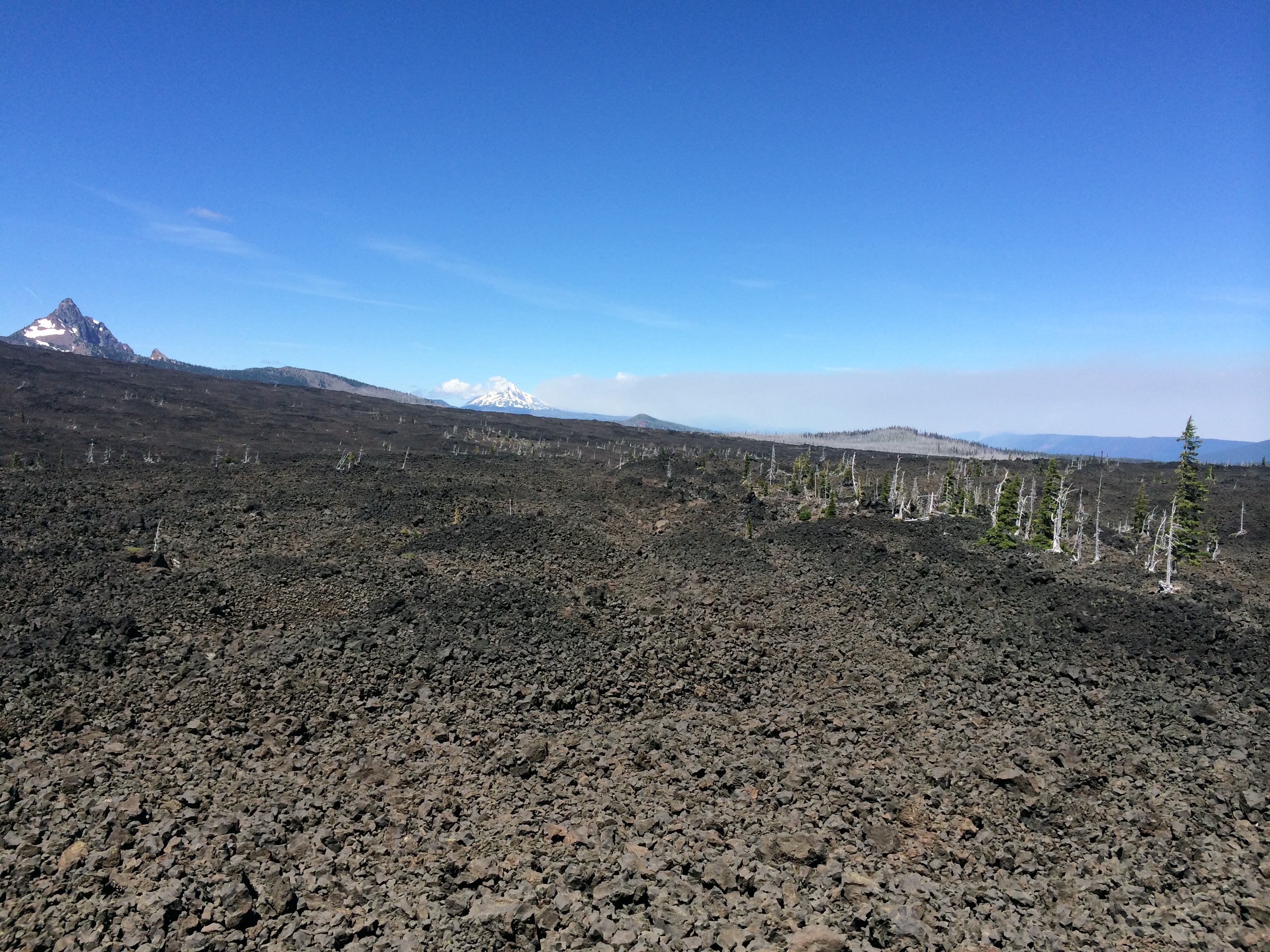
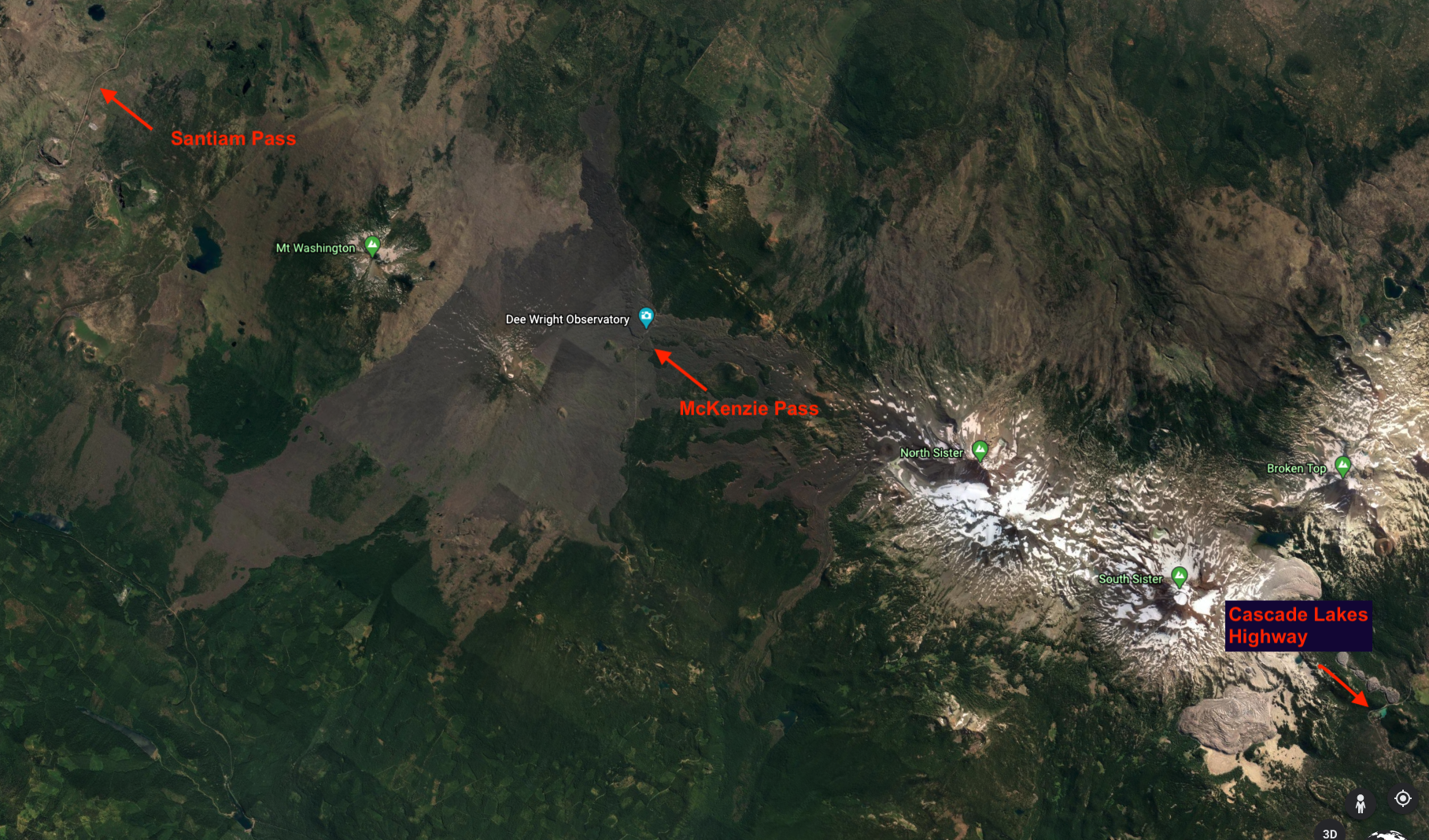
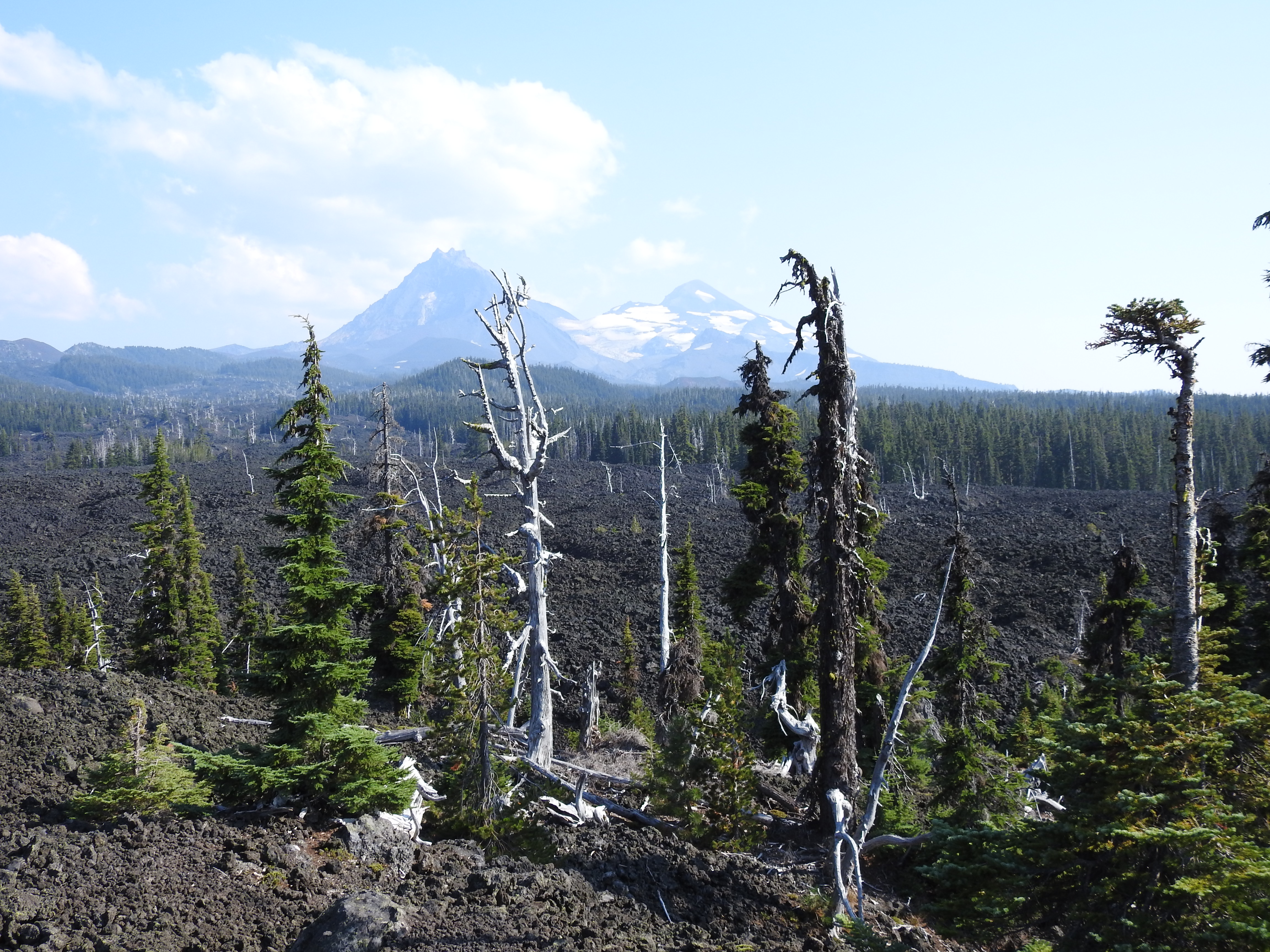
Now, onto geology! While the road has been skirting the 85 square mile lava flow through the uncovered forest, you will soon have no choice but to travel through the lava field itself. But luckily, you are driving on a paved highway, unlike the Native people and wagon road settlers before us. Parts of this lava field were formed as recently as 1,500 years ago by Belknap Crater, the Yapoah cinder cone, and other volcanic vents. Different from the stratovolcano that erupts with spewing lava, the Belknap Crater shield volcano is much like the volcanoes of Hawaii that release fluid lava flowing in all directions.
I highly recommend exploring the Google Maps or Earth satellite view of this area to experience the remarkable landscape from above. You can view the 7,000 foot Belknap Crater from the road or by climbing up the Dee Wright Observatory ahead. Fun fact, it was named for the son of the Belknap Hot Springs developer who was heavily involved in the creation of the toll road in the 1870s. But, before you get to the top, there is an Insta-worthy photo opportunity of the Three Sisters mountains at a pullout ahead on the right.
Near the summit, you encounter the Pacific Crest Trailhead, known historically as the Oregon Skyline Trail. This foot and equestrian trail ran north to south and was originally established between Mount Hood and Crater Lake in 1920. It was extended into the entire state of Oregon in 1936, and in 1968, was integrated into the Pacific Crest Trail. Today, the Pacific Crest Trail, often called the PCT, extends from the US border at Mexico traversing 2,650 miles to the border with Canada crossing California, Oregon, and Washington. Less than one thousand people attempt to hike the whole route each year and just over half of them actually make it. From the same parking lot of the PCT, you can also go explore parts of the original 1870s wagon road just a few hundred yards from your car. While they haven’t been in use for over 100 years now, there is surprisingly little change.
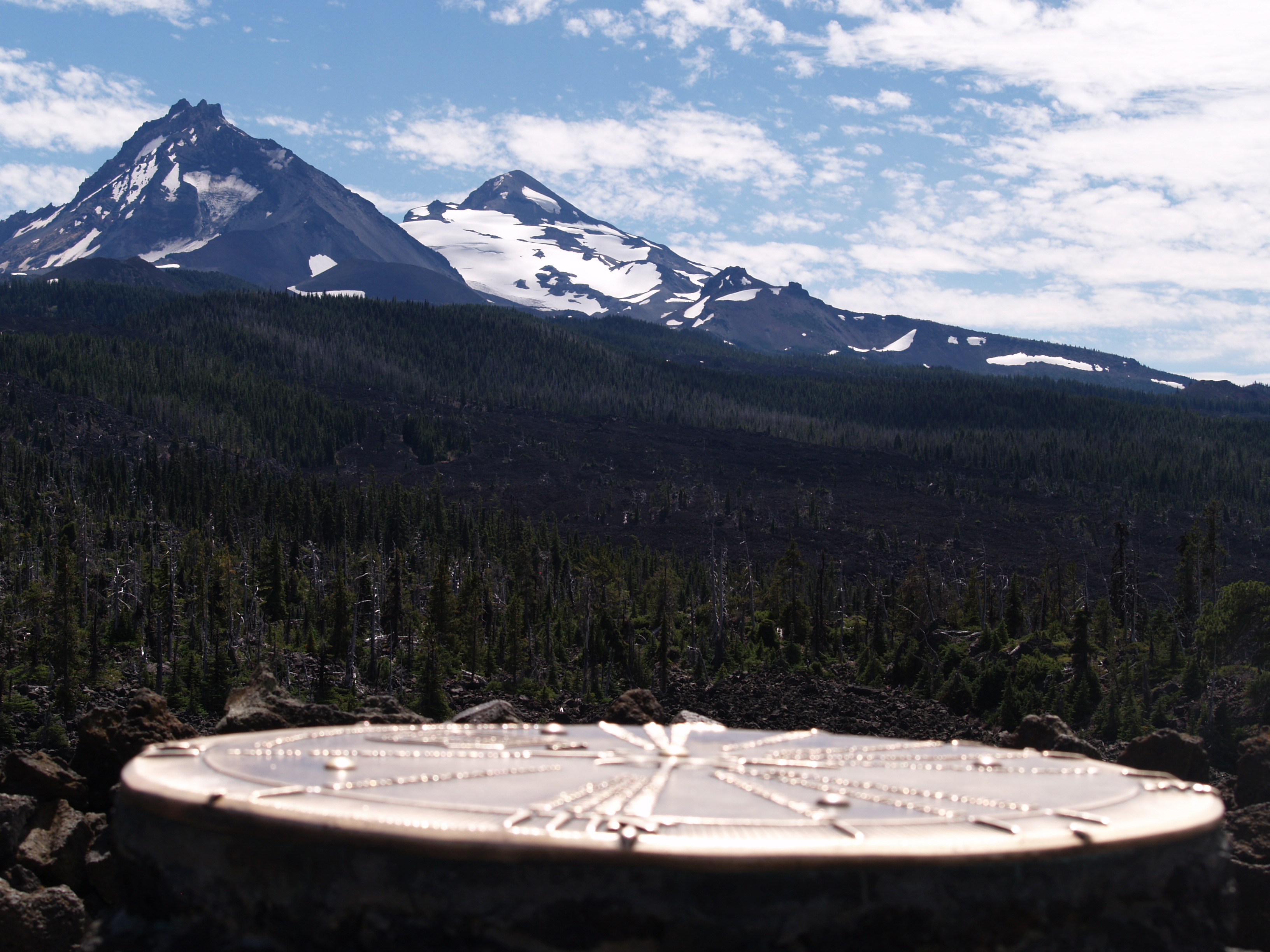
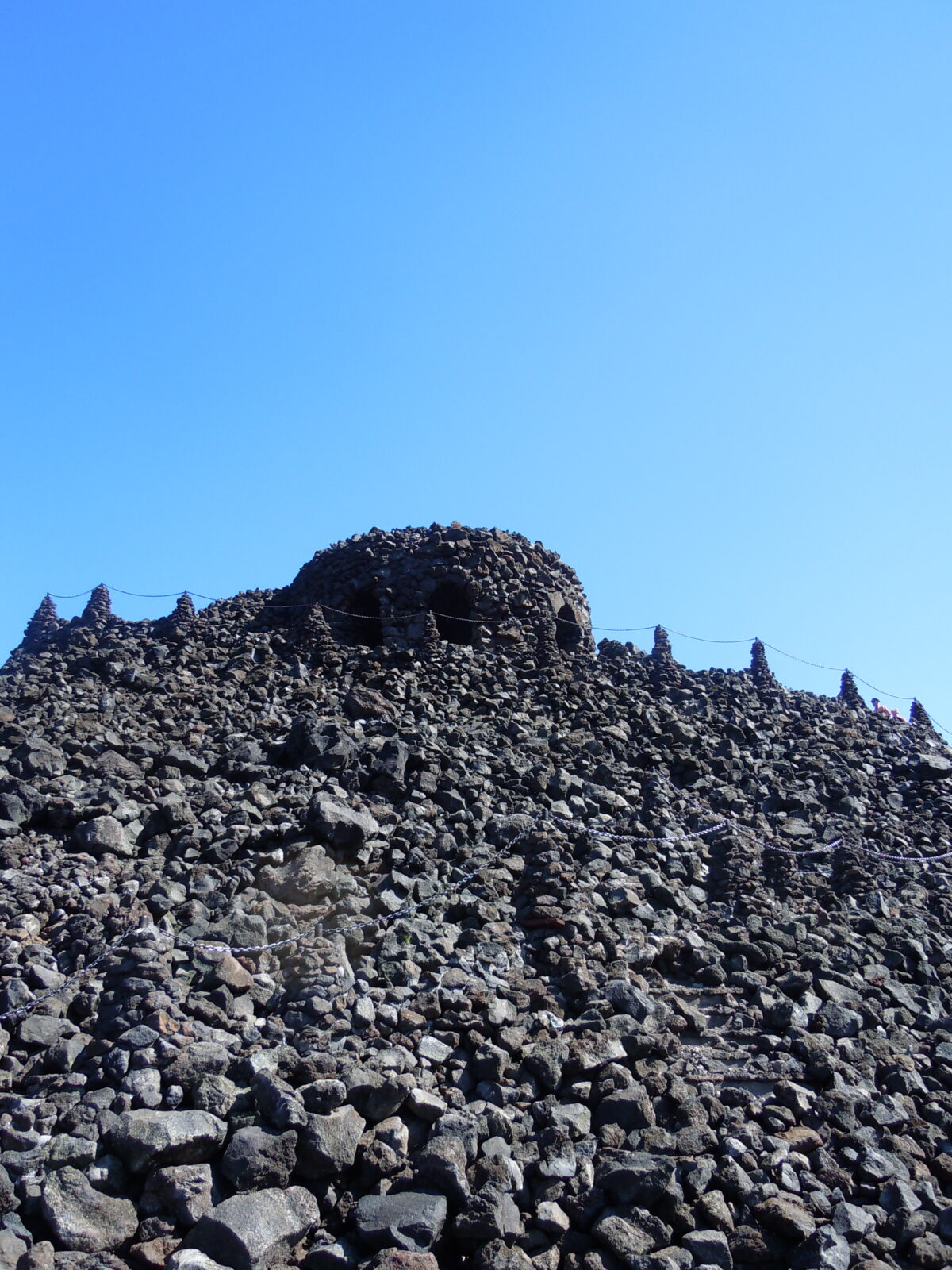
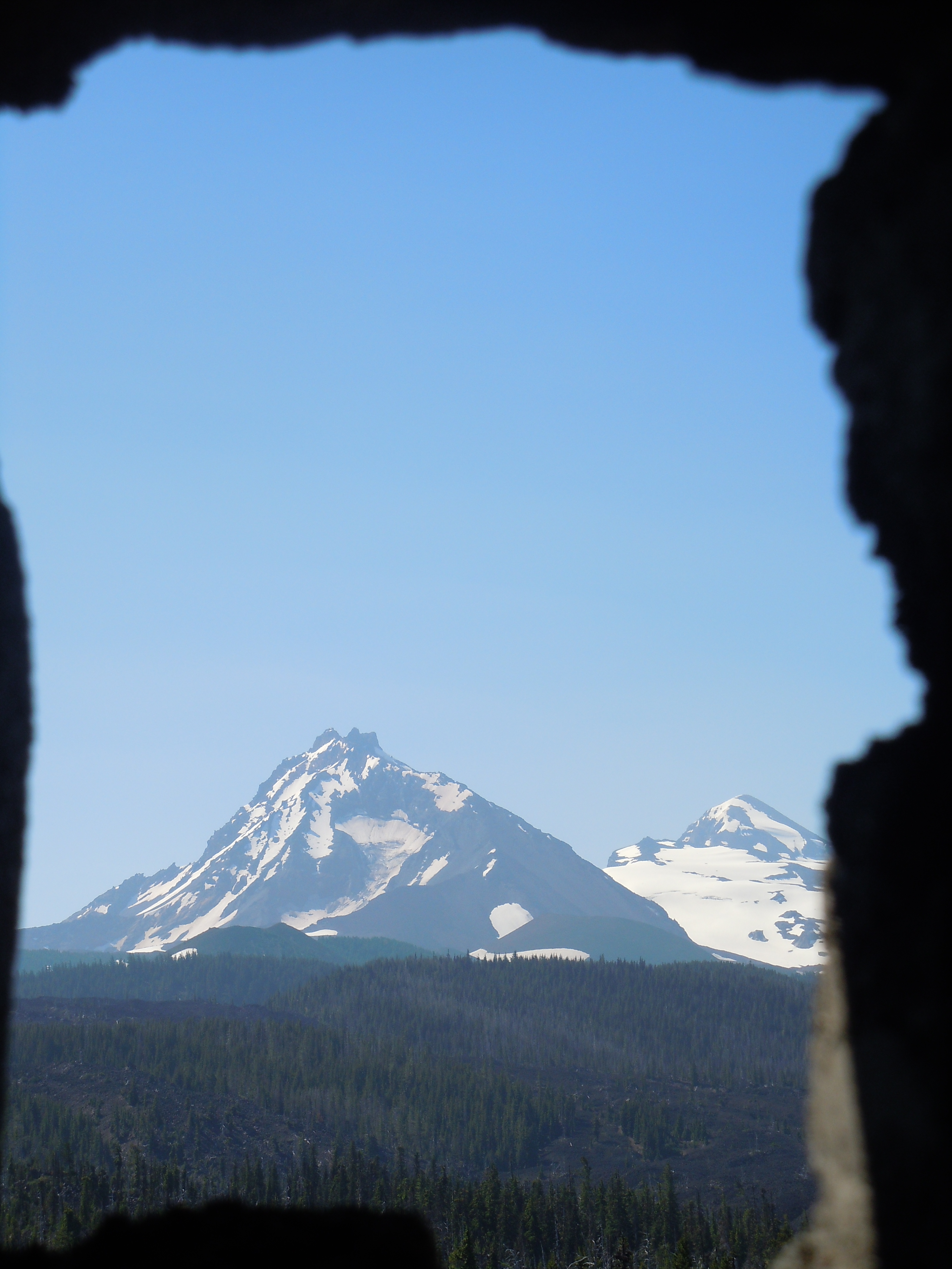
And just like that, you arrive at Dee Wright Observatory. With parking on both sides of the highway, this is a must stop location on this journey. It’s built out of basaltic andesite lava rock and was completed in 1935 by the Civilian Conservation Corps, or CCC for short. It was named for the CCC foreman Dee Wright who died just after completion. Due to his accomplishments as a foreman, forest service guide, trail builder, and all around wholesome Oregonian, the observatory was named in his honor. The CCC hand built this structure as a shelter for travelers passing through the area, and, as the plaque inside tells us, “to facilitate public enjoyment of the unusual and interesting combination of historical and geological features nearby.” You can walk up to the observatory, read informational signs along the way about Native American and settler experiences, continue inside to view each mountain through the lava framed windows, and finally, climb to the top for the ultimate 360 degree view of the High Cascade mountains and their glaciers as well as a bronze peak-finder to assist with naming the geologic features you witness. From this location, the North and Middle Sister feel close enough to touch on a clear day, you can even see Mount Hood, 78 miles to the north!
Before you leave the 5,325 foot summit, I want to make sure you didn’t miss the Lava River National Recreation Trail just east of the observatory. This easy half-mile paved trail takes less than a half an hour to complete and has multiple interpretive signs describing the geological formation of this post over 2,000 years ago. There is also a turnoff to the right providing more parking, primitive drive in camping, and access to more backcountry trailhead but don’t forget, you guessed it, the permits! And now, about the astronauts! If you have thought this lava strewn landscape looks like the moon, you aren’t the only one. During the mid 1960s, NASA started sending future lunar astronauts to areas like Hawaii, Iceland, and various locations in Central Oregon to study the geology and experiment with pressurized space suits on the uneven and sharp terrain. NASA started referring to the Bend area as “Moon Country” and locals befriended the future astronauts. Rumor has it, Apollo 15 astronaut Jim Irwin was sent a rock by an Oregonian friend subsequently placing it on the moon in 1971! If this is true, then Oregon is definitely out of this world!
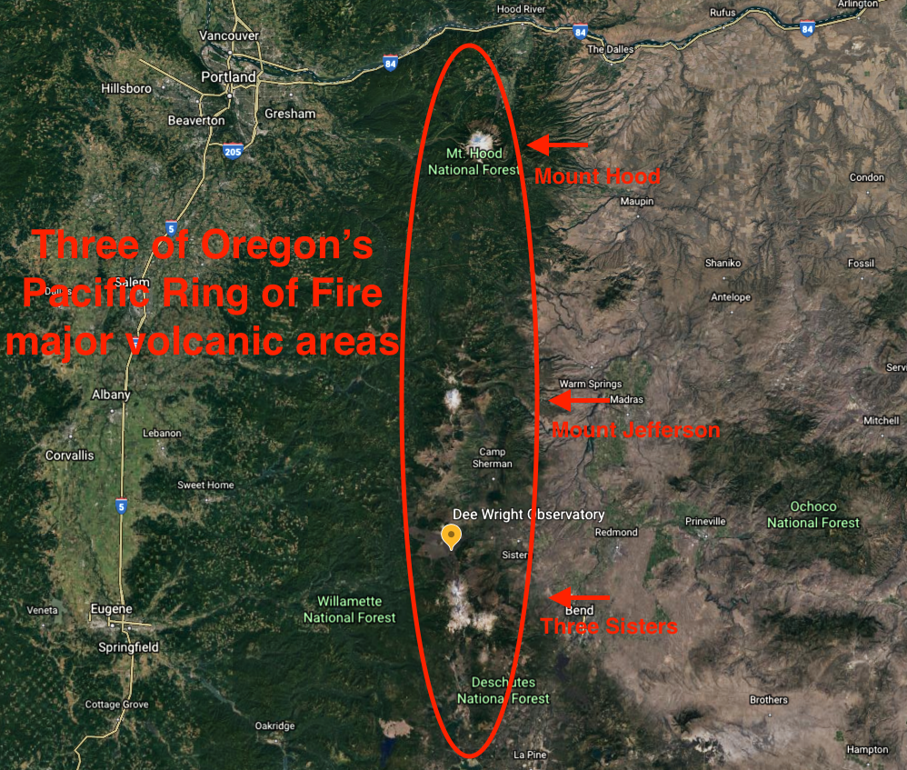
After the pass, you descend from the McKenzie Pass summit and not lose that much elevation as Central Oregon sits at over 3,000 feet. Since you learn more about specific Cascade mountains on the drive from Sisters to Bend, I’d like to share a bit about the Cascade Mountains in general. Stretching from British Columbia in Canada down to Northern California. This mountain range is part of the Pacific Ocean’s Ring of Fire and is the source for all eruptions in the lower 48 states for the last 200 years. Locals who are old enough to remember surely recall the most recent eruption of Washington’s Mount St. Helens in 1980. In Oregon, the Cascades cover 17% of the state, an area larger than the smallest nine States. Almost all are volcanic, and formed out of the Cascadia Subduction zone, a convergent plate boundary where the ocean floor is gradually slipping under North America, causing deep earthquakes and active volcanism. Geologically speaking, these mountains can be divided into the Western Cascades, or Old Cascades, and going to the High Cascades, newer mountains with more potential for future eruptions. Maybe you have heard of the famous Oregon volcanoes: Mount Hood, Mount Jefferson, the Three Sisters, and Crater Lake also known as Mount Mazama. A trivia question for the car…what are the two main types of lava?
To the east, just after you leave the pass, is the trailhead for Black Crater, a difficult 7 mile out and back hike that was heavily damaged in the 2017 Milli Fire. The hike itself might seem mundane after the wonders you’ve encountered on the drive but ends in a red cindered peak and views of the lava field below. A quarter mile past there on the left is your last chance to view the lava field as you head towards Sisters. At Windy Point, you get a great view of Mount Washington and more interpretive signs about the geology of the area.
I hope you have enjoyed our journey to the moon-like part of Oregon. Central Oregon is filled with information about volcanoes and geology. If you are interested in learning more, I highly recommend the Lava Lands Visitor Center, the interpretive hub of the Newberry National Volcanic Monument. Just 20 minutes south of Bend, it offers an amazing 3-D topographical map of the area and takes you deep underneath the Earth’s surface. Did you figure out the two types of lava? Pahoehoe and A’a. Like many other volcanic terms, these names are derived from the Hawaiian language. There is actually a third one named pillow lava only found on the ocean floor.
Well that wraps up the McKenzie Pass for now. Again, it is best explored with our app.
In case you don’t know, Together Anywhere has created a way to explore Oregon through stories while driving, remaining separate from other travelers as you go down the road, learning more about this beautiful place we get to live. This short post is an example of our tours, except our tours speak to you. You just download the app, choose your drive, and you are on your way!
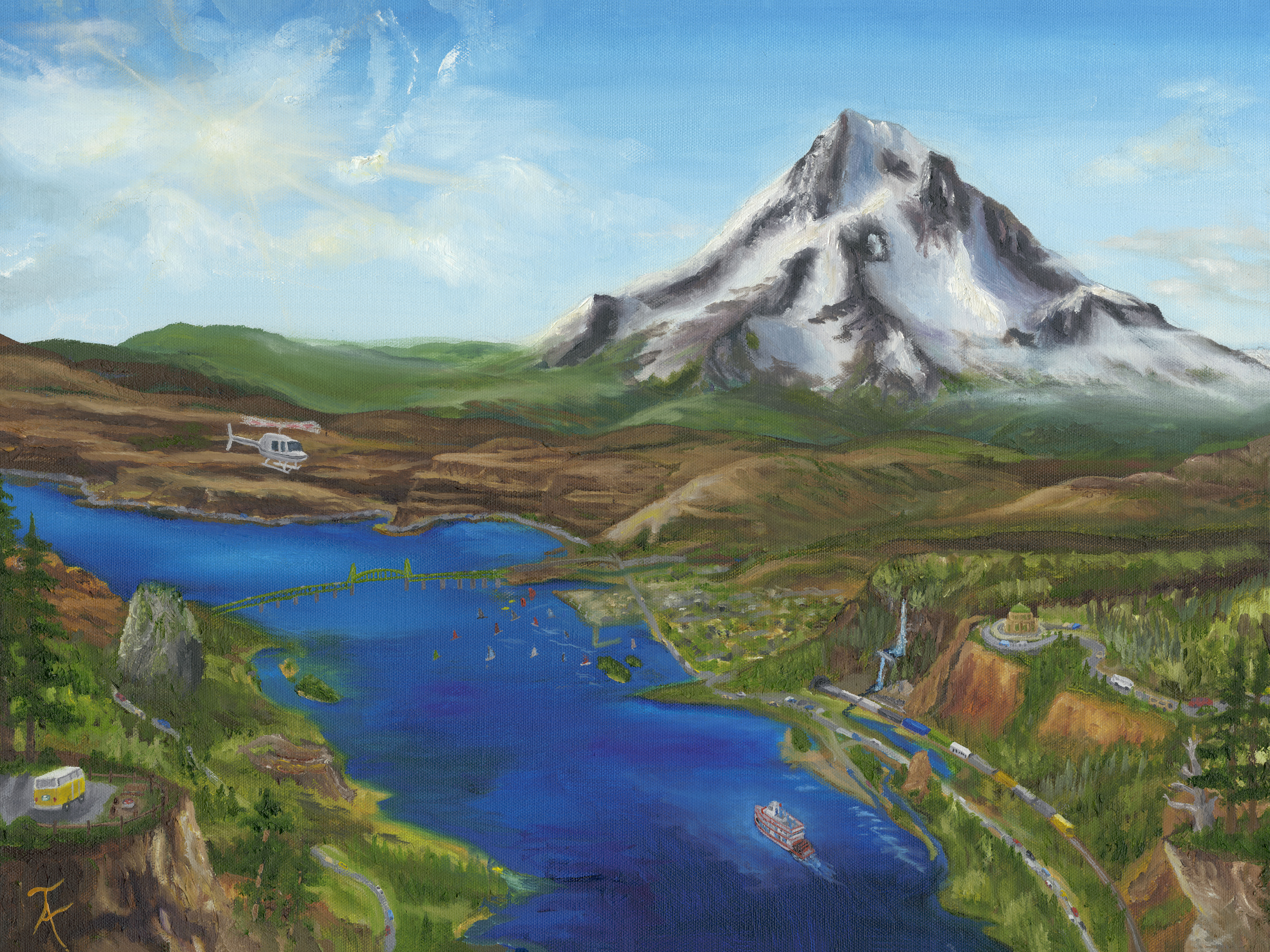
We have tours available around Mount Hood and the Columbia Gorge as well.
2 replies on “Let’s go to the moon! In Oregon?”
What a wonderful article with so many interesting facts and information about that area. I feel I need to check this place out next time I go near that area. Thank so much for posting this.
Thank you for your comment Geri! So sorry this was overlooked before!