Are you finding out new ways to explore Oregon during this time of social distancing? With Together Anywhere, you can experience a mini road trip like you never have before. Our GPS location based app tells you stories and places to visit that you may have missed before. We’ve spent years discovering, researching, and writing down the best information that make these areas worthwhile destinations, especially during this time of social distancing and staying close to home.
If you are more of a watcher than a reader, you can check out our North Santiam Canyon Road Trip YouTube video here. And if you want to take an ACTUAL road trip, just make sure to download our app for Apple iOS or Google Play before you go. The following are just ten of the HUNDREDS of narration points along Oregon roads.
Ready to take a road trip? Well let’s get going!
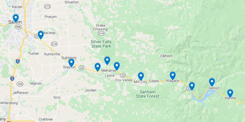
Location #1: Salem, Oregon. Our journey begins here at the Travel Salem Visitor Center. This location is a great resource for all adventures starting and ending in the Willamette Valley. We drive east on State Street as we make our way out of town.
Ahead to the right, you will first notice the Hallie Ford Art Museum that sits at the corner of the Willamette University campus. Willamette is now known as the oldest university in the Western United States, after being founded as the Oregon Institute by missionary Jason Lee in 1842. This 60 acre campus sits in the middle of Salem and educates about 3000 students a year.
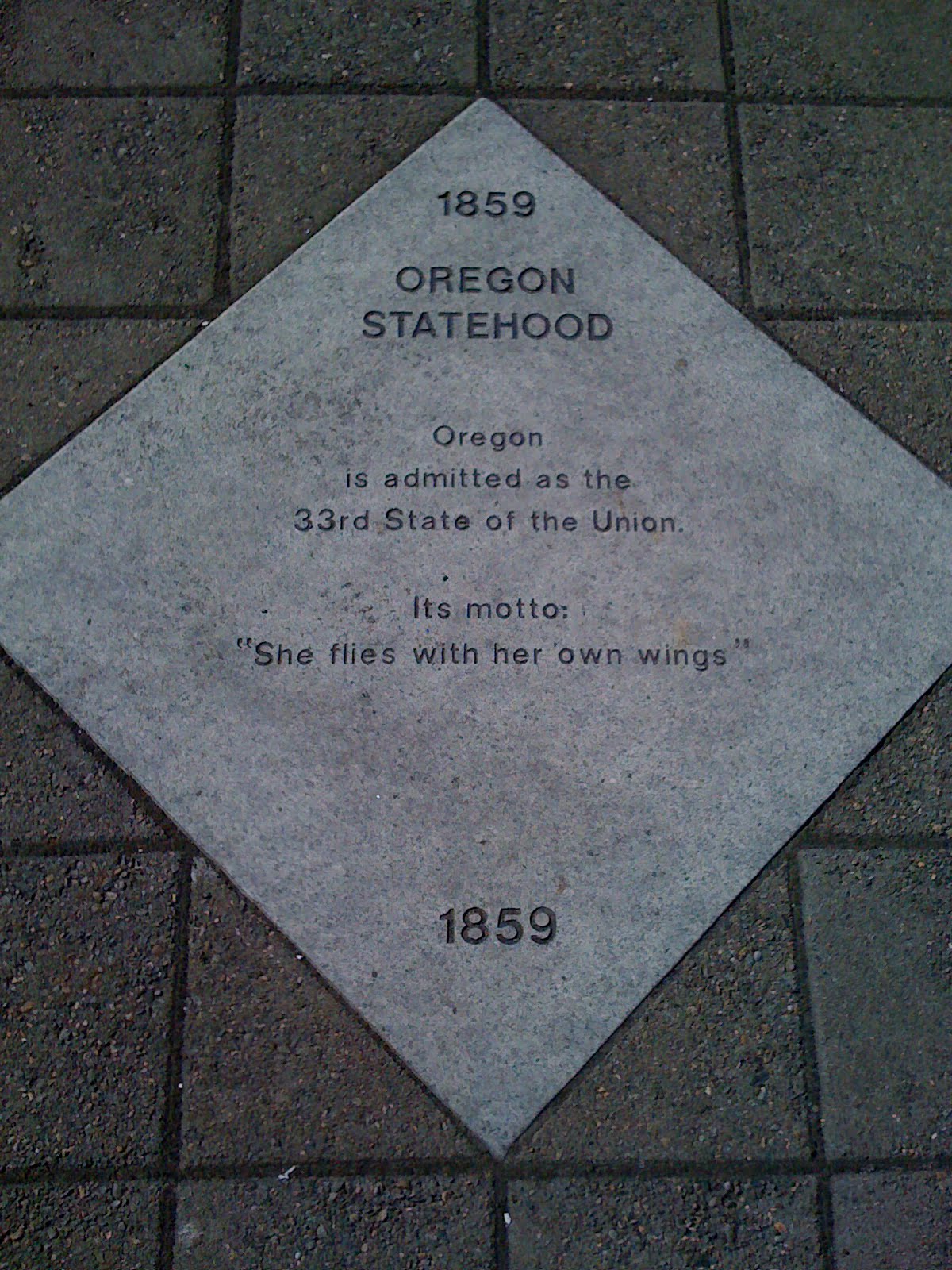
On the opposite side of the street, you might catch a glimpse of the eight and a half ton Gold Man, sitting on top of the third Oregon State Capitol building, constructed in the 1930s after the first two were burned. The city of Salem, named from the Hebrew word for peace, became the official capital city of the Oregon Territory in 1855. It would be 4 more years before Oregon became a state in 1859.
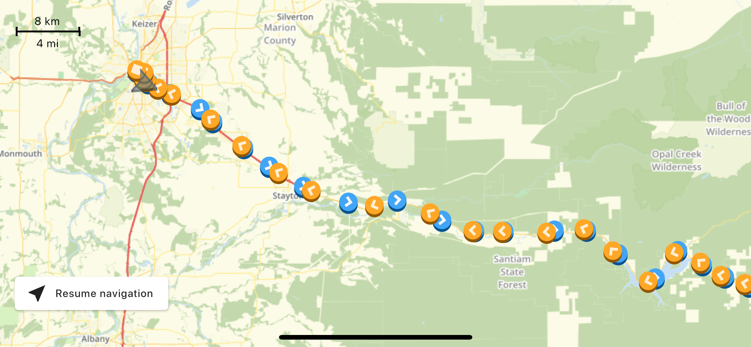
Location #2: Highway 22 journey begins. Welcome to the North Santiam Canyon Highway 22 where we won’t see another stop light for nearly 100 miles. Enjoy the transition out of the city while I tell you a little bit more about how the day is going to work. I’ll point out anything I find interesting along the way while telling you the history of how this area came to be what it is today. The first portion of our tour passes through many small towns, once booming from the mill and timber industries, now shifted their focus to recreation such as hiking, rafting and fishing to name a few. There will be a lot to see along the way, but I have a few great spots in mind that I would like to tell you about. This is a journey with winding turns, cyclists, pedestrians and maybe even some wildlife. I have some great suggestions for places to pull over, but should you choose to stop elsewhere, be sure to get fully off the road while paying close attention to your surroundings. The short of it: Take your time, share the road, and enjoy this wonderful part of Oregon.
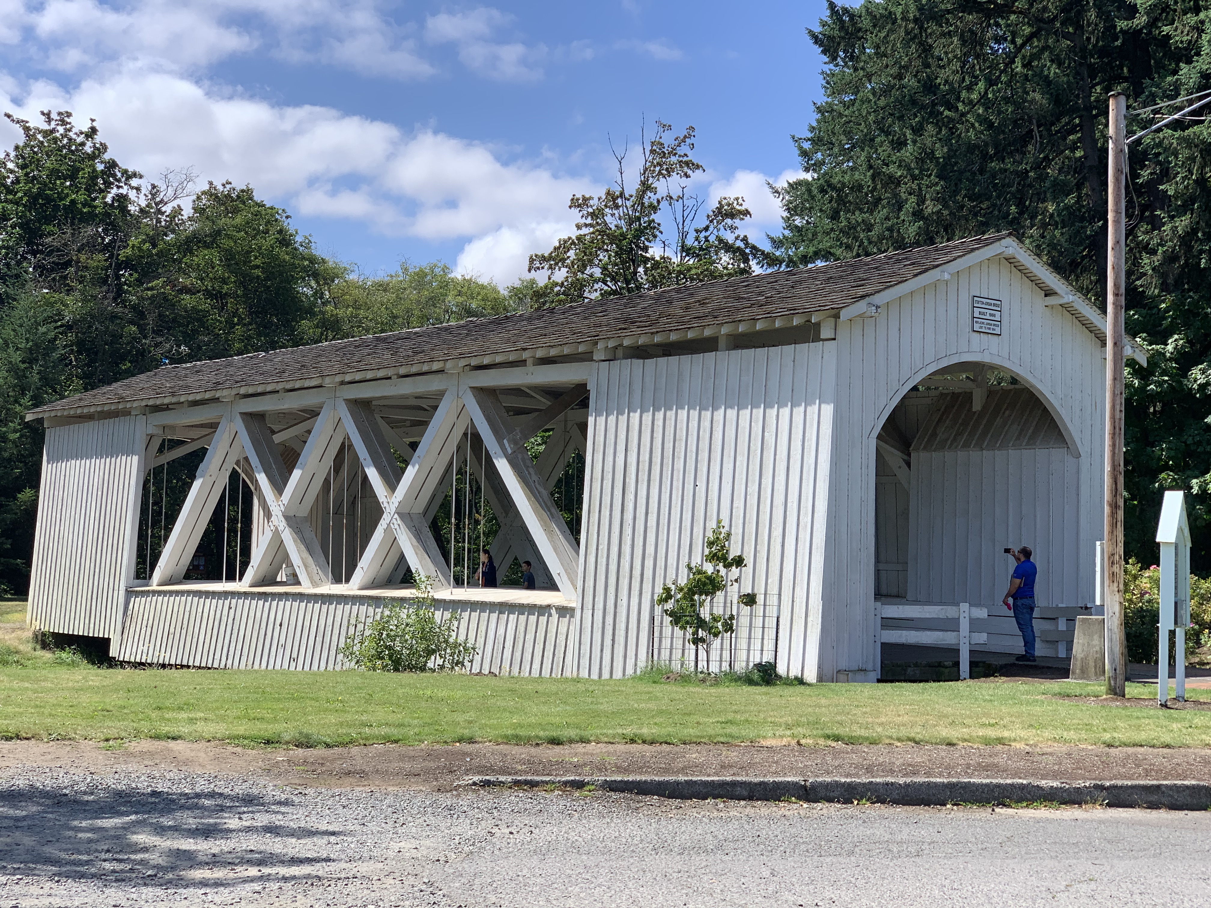
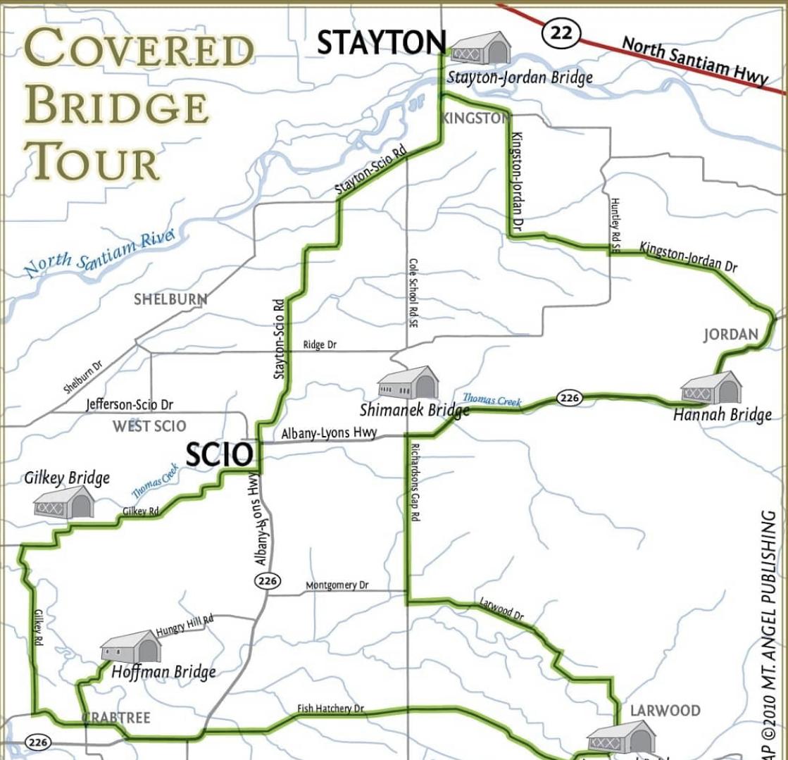
Location #3: Stayton-Jordan Covered Bridge. Oregon has the largest collection of covered bridges in the west and one of the largest in the nation. The turnoff to Stayton ahead provides the opportunity to take a short covered bridge tour between the towns of Stayton and Scio, giving you the opportunity to see 6 of the 51 covered bridges in Oregon. I recommend that you start at the Stayton-Jordan covered bridge located at Pioneer Park just near the center of town and follow signs to complete the short loop to Scio and back. When looking at the map, you can observe that Stayton is a confluence of waterways surrounding the Santiam River and began as many towns in Oregon did, as a hub for sawmill industries. With a population around 8000 people, Stayton offers another opportunity to find a large grocery store and other amenities before we head down the sparsely populated canyon. The town just north of the highway, Sublimity, was named for none other than its “sublime scenery in the hills” back in 1852.
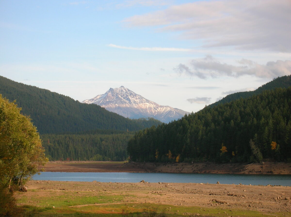
Location #4: A confluence of waterways and a waterfall. This merger into a two lane highway indicates our arrival to the North Santiam Canyon corridor where we will closely follow the North Santiam River for nearly 60 miles. While loosely called the Santiam River, this is actually the North Santiam River, joined along its 92 mile journey by many tributaries on the western side of the Cascades. The North Santiam joins the South Santiam near Jefferson, Oregon and travels about 12 miles before it reaches the Willamette River and heads north to the Columbia River before meeting the Pacific Ocean.
While occupied by the Santiam people of the Kalapuyan tribe, this river was an obstacle to overcome by the early settlers in this region. It wasn’t until the late 19th century that the Oregon Pacific Railroad laid the foundation for opening up the canyon and providing opportunities for industry and settlement. The construction of the Detroit Dam in the 1950s changed the natural flow of the river, reducing the likelihood of floods in the farming communities around the North Santiam.
If you have an hour or two to spare, turn left on Fern Ridge Road in Mehema and drive just over a mile to reach the Shellburg Falls Trailhead. This easy 2.8 mile out and back is identified by Oregonhikers.org as a “great way to spend a lazy afternoon, particularly with children or inexperienced hikers.”
Location #5: A timber story. When you ask any local in the area about the history of their Oregon, you will surely hear the storied past of the timber industry. While we make our way towards the steep mountains that flank the North Santiam River, we can only imagine the difficult journeys of Native Americans and early settlers of the region. It was the arrival of transcontinental railroads in the 1880s that changed all of that. Once there was a way to carry the Douglas-firs out of the area, these forested valleys became the epicenter of lumber production. The railroad was eventually replaced by the arrival of heavy duty logging trucks in the 1930s with most rail lines ceasing operations in the late 1960s.
While the Depression Era affected the rapid growth of the timber industry in the early 1900s, by the post-war 50s and 60s, these communities were booming again with life and industry. Dams were being built, trees were coming down, and there was nothing but optimism in the valley. Once the effects of pesticides and herbicides were deemed unhealthy for the forests, practices were greatly reduced but no one saw it coming when the small, Northern Spotted Owl was placed on the Endangered Species Act in 1990 and single handedly decimated the industry as it finds its home in Oregon forests. During the 1990s, the harvest from federal forests fell by more than 90 percent. Oregon’s employment hit was mostly offset by the arrival of the tech industry but rural communities who found their identity in timber are still feeling the effects of the end and repositioning themselves as centers for outdoor recreation which, has its own impact on the sustainability of the area.
You can learn more about the rise and fall of the timber industry by visiting the Canyon Life Museum up ahead in Mill City. One of the two buildings in housed in the old train depot and the other, a former Santiam Lumber Company building, both renovated by the North Santiam Historical Society.
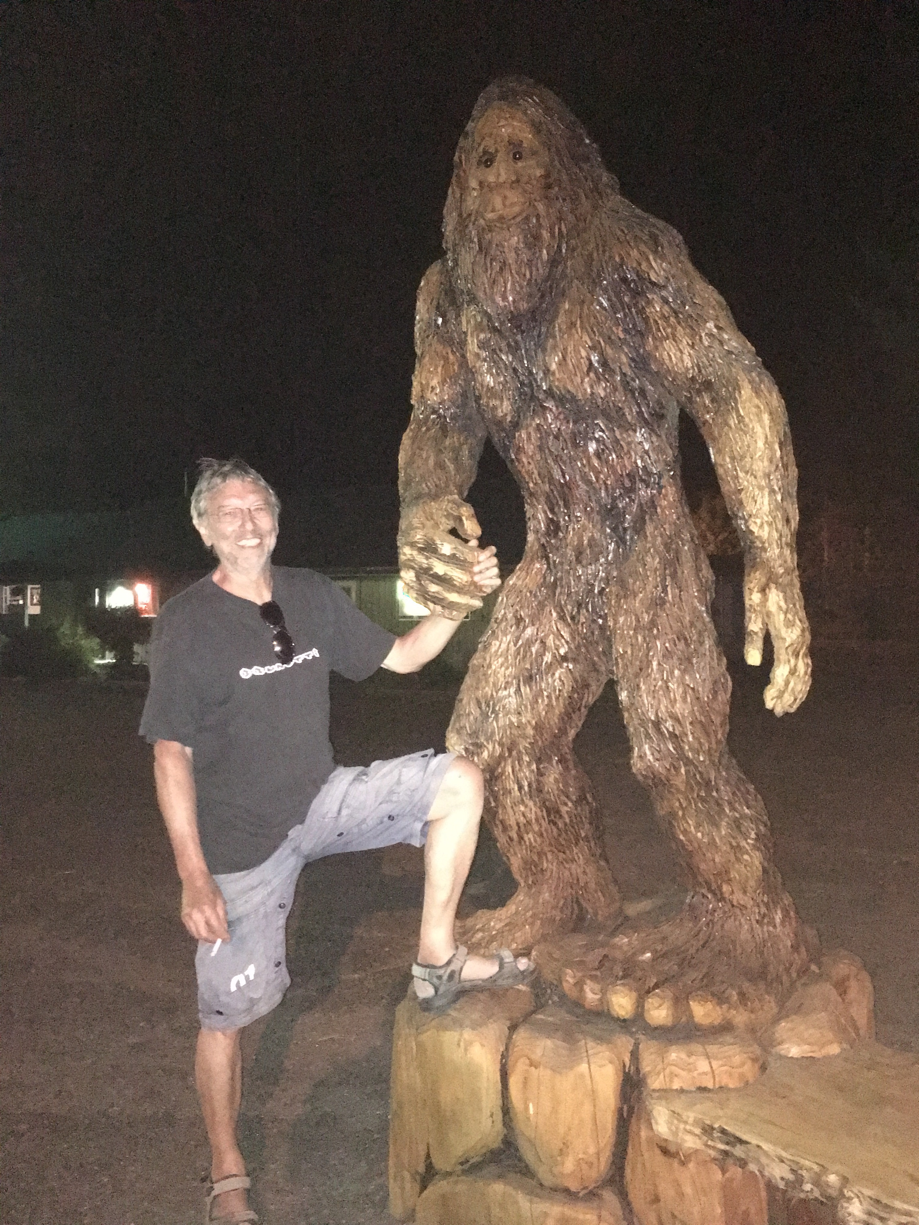
Location #6: Mill City. We will gradually slow all the way down to 40 miles per hour as we enter Mill City. Make sure to keep an eye out for bigfoot on the left! Even with the decline of the mill industry, this has remained the largest community in the North Santiam Canyon with about 2000 people seeking a respite from the big city living. This quaint town provides another chance to fuel up or stop at one of their popular eateries. My favorite place to stop after a hiking or boating adventure has always been Giovanni’s Mountain Pizza where you can watch them spin the handmade pizza dough or eat some of their famous breadsticks. I recommend the Roman pizza.
The city had a successful campaign to save their historic railroad bridge with a centennial celebration in 2019. This bridge was actually constructed in 1888 and moved to Mill City in 1919, by Southern Pacific Railroad.
The bridge reflects the connection that Mill City and the North Santiam Canyon have had with the railroad. If it wasn’t for the railroad and the timber industry, Mill City would not be what it is today. Southern Pacific Railroad suspended service to Mill City in 1967, and in 1971 the last train crossed the bridge.
Mill City’s Historic Railroad Bridge will continue its use as a bike and pedestrian trail, enhancing civic vitality in the North Santiam Canyon.
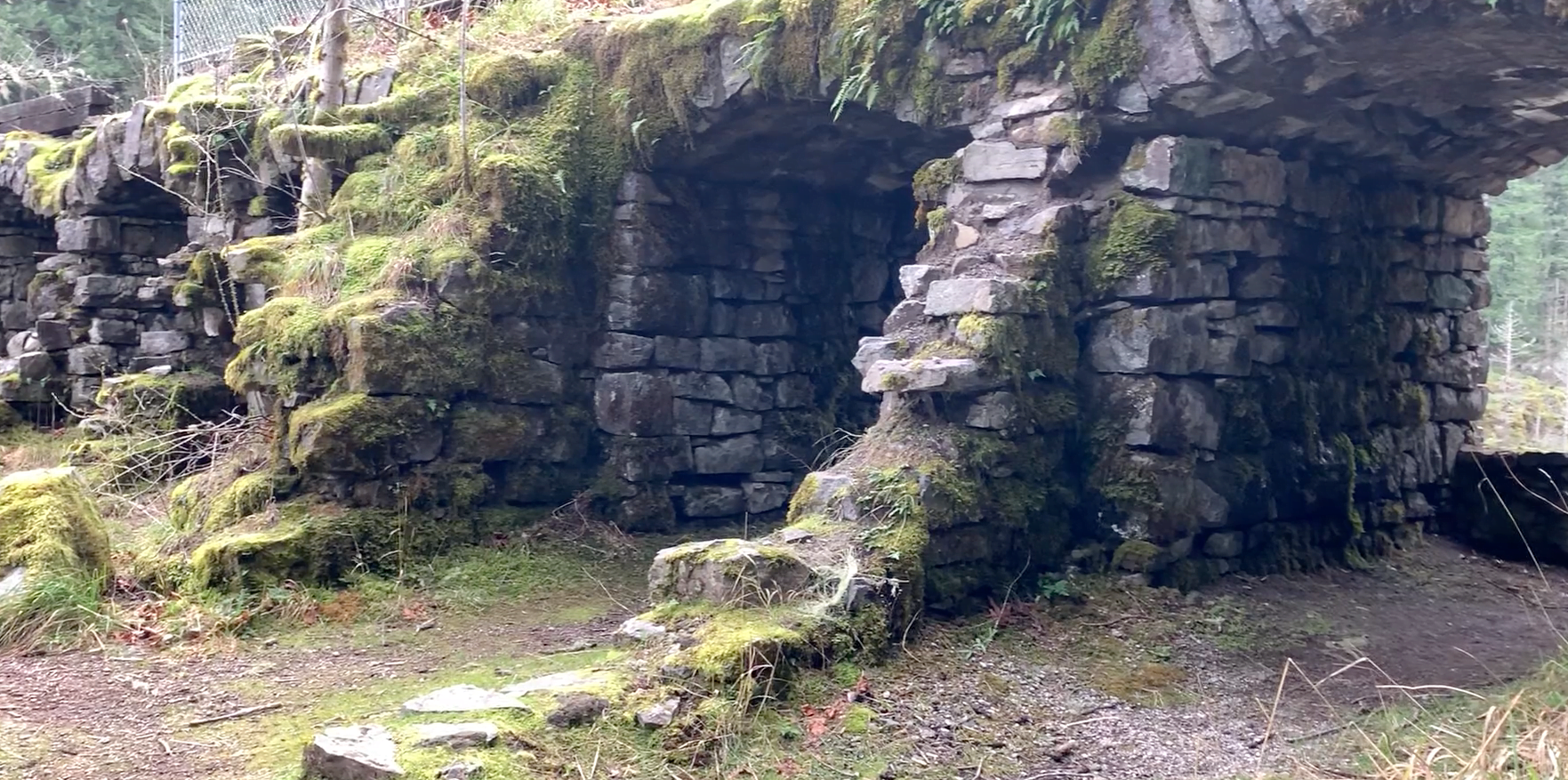
Location #7: Niagara Park and waterwheel. We just passed Packsaddle County Park, a popular launching spot for those adventurers going down the Santiam River whitewater. Two features up ahead on opposite sides of the road are worth a photo if you have the chance. On the left, the Niagara Heights Water Wheel sits as a roadside attraction on private property. Thanks to the work of the machinist owner and a bit of crowdfunding, the wheel has started turning again. While it does not actively generate power, it is a wonderful replica of the first machinery to replace human and animal power. Across the road from the wheel is Niagara Park, the oldest Marion county park established in 1955. It is named Niagara for the narrow gorge in the North Santiam River that settlers viewed as a perfect waterpower site in the late 1800s. You can see the gorge and the masonry dam that was abandoned in 1912 by walking down a short flight of stairs.
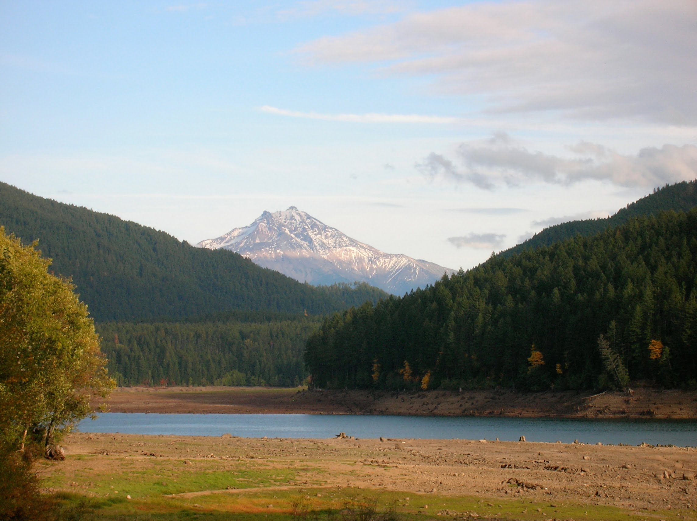
Location #8: Detroit Reservoir. The North Santiam River is about to open up into a large reservoir that is known in recreation speak as Detroit Lake. This 9 mile long reservoir starts here at the Detroit Dam, which rises 463 feet out of the North Santiam River. Completed in 1953 alongside the Big Cliff Dam, it transformed the 60 miles of land down the canyon and works to regulate the amount of water flowing into the lower parts of the North Santiam River. Managed by the US Army Corps of Engineers, you can visit the dam daily by walking or taking a drive over it, but maybe you are more interested in just taking a dam picture. The reservoir behind the dam changes in size with the season, and dependant on rainfall the surface of the water can fluctuate up and down by 120 feet. In the summer, it is usually at its fullest and is known by recreation tourists for its fishing, boating, water sports, and swimming. In the winter, you can view a forest of tree stumps, uncovered as the water level drops after the typical dry Oregon summers. But year round, those alongside the North Santiam Canyon experience the riches of the Detroit Reservoir as it is the source of their drinking water. Ten cities, including Salem, draw their water from the North Santiam watershed. We will be driving along this reservoir for awhile longer so I’ll tell you a bit more as we slow down for some tight curves and enjoy the scenery of the Detroit Lake area.
Location #9: Detroit, Oregon. As we curve around this upcoming bend, we will slow down and see the town of Detroit found at this location since the 1950s. This is your last chance to stock up on fuel and other provisions before heading over the pass. While we will have one more opportunity for snacks, the next gas station will not appear for another hour.
By taking a left turn over the bridge, you have the chance to travel the northern section of the 220 mile West Cascades Scenic Byway. Skirting the west side of the Cascade mountains, the byway follows Forest Road 46 along the Breitenbush River until it parallels the “Wild and Scenic” Clackamas River all the way to Estacada, a small community southeast of Portland.
This route is also known as the Cascading Rivers Scenic Bikeway, a 71 mile expert trek for the most serious cyclists out there.
Eight miles down Forest Road 46 is a location that deserves more story time than is available as we pass by. But I’ll try to give you a good synopsis.
Breitenbush Hot Springs Retreat and Conference Center sits on top of the natural geothermal springs area that was once a frequent gathering place for Native American groups passing through.
The springs were first encountered by European trappers well before the establishment of canyon settlements as early as the 1840s. John Minto, a name I have already mentioned once today and will talk about more in a minute, named this spot Breitenbush after a one-armed hunter living in the area during the 1870s.
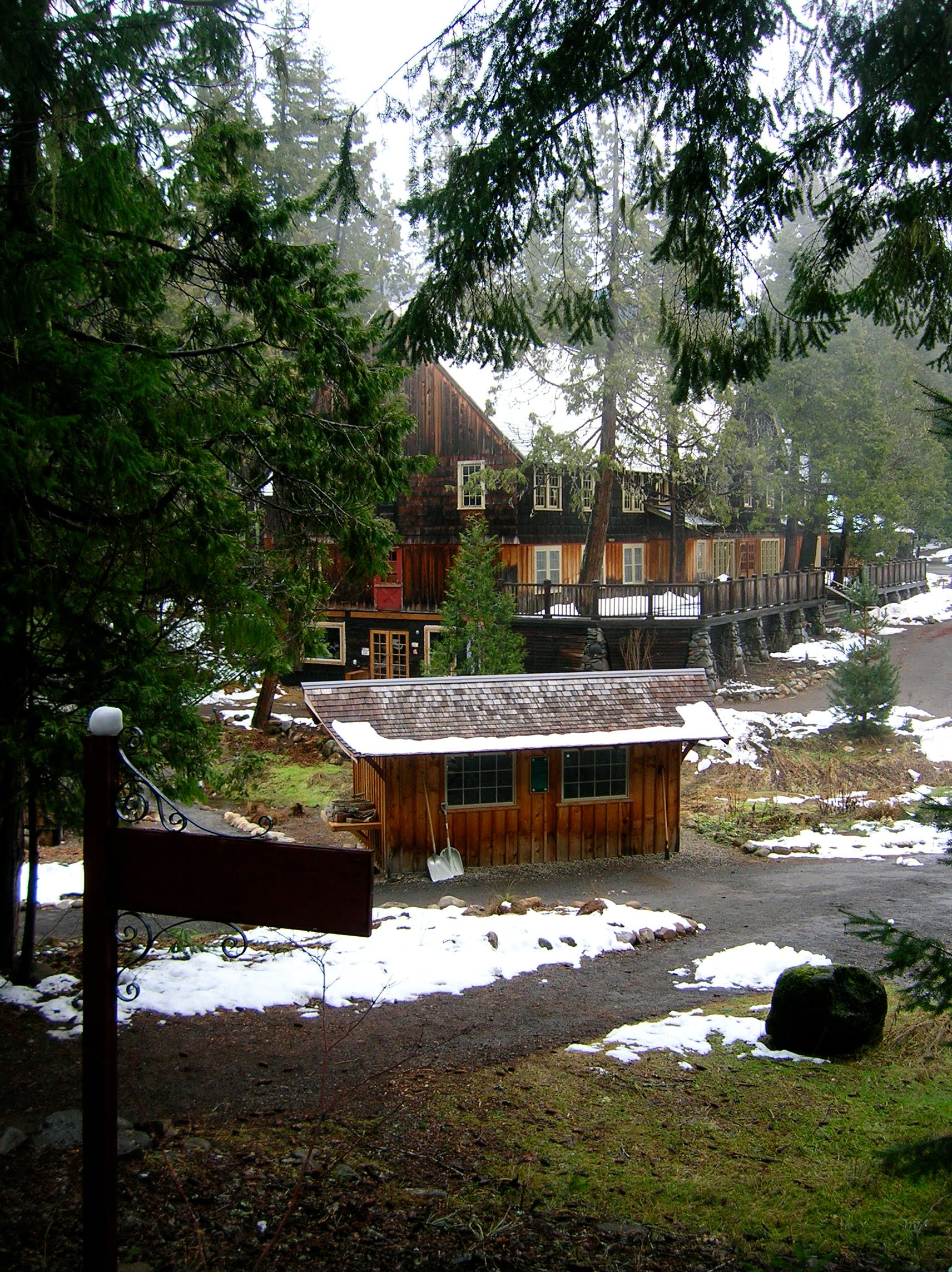
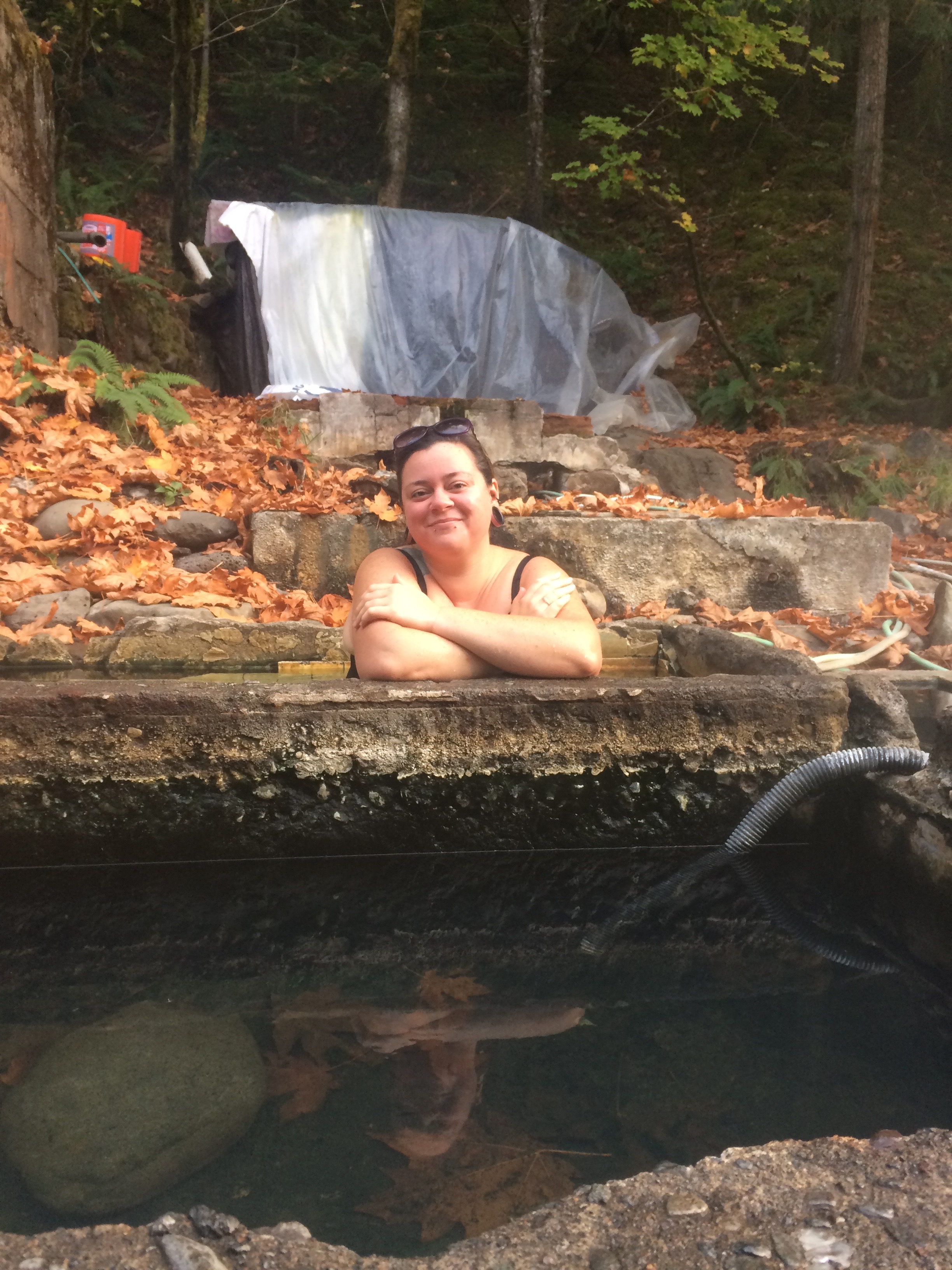
The springs at Breitenbush emerge from the ground at one hundred and eighty degrees fahrenheit. The current retreat center, known for its counterculture, holistic, spiritual, and New Age workshops, was developed in 1981 after a storied history of ownership and threats to the natural environment. The community of Breitenbush now operates seven, clothing optional pools. The center is the largest private geothermal facility in the Northwest and holds sustainability in high regard, producing their own hydroelectricity and preparing only vegetarian food for their guests. The permanent cooperative community has between 50 and 70 residents and provides opportunities for camping, staying in one of their cabins, or just visiting for the day. Make your reservation online before visiting the retreat center as the number of allowed daily visitors is limited.
Location #10: Idanha, Oregon. Nothing ties this road trip together like a stop at the Idahna Country Store up ahead. I just love coming to this small store to stock up on snacks and other road trip worthy items. And nothing beats a cone of Oregon made ice cream and a conversation with Sharene, always serving up a smile for travelers passing through. My favorite is the salted caramel ice cream topped with a shot of espresso. Just tell her Together Anywhere sent you!
Idanha, originally known as Muskrat Camp, was the eastern endpoint of Colonel Hogg’s Oregon Pacific Railroad dream after the company ran out of money to go any further. The rail line continued running to Idanha until the 1950s primarily serving the timber industry. But when the Detroit reservoir filled, the tracks were removed, and this rail line met its fateful end.
Once home to 5 mills, Idanha is now a small community in the center of an outdoor tourism mecca…and continues to be the best ice cream stop I’ve found in Oregon.
Well folks, that is it for now. I have so many Oregon adventures to share with you. Hopefully you will check out my app and let me know what you think… and tell me about which Oregon roads you want to hear about next! And remember – your adventure is ready with Together Anywhere!
2 replies on “10 places to see in a one hour drive: A mini road trip down the North Santiam Canyon”
I have lived here in this canyon all my life as well as my parents & kids we all have a total ❤️ of our community & Canyon.
Just one thing to know is the latest is the 2020 Santiam Canyon Fires 🔥. Maybe you can update the website on our recovery of the Canyon.
Hi Laurie, thank you for your comment… we love the canyon too which it is why it was one our first tours (we now have over 6). We unfortunately created this tour just before the fires so we still have a lot of updating to do. A similar thing happened with our McKenzie River tour but we were able to secure funding there from the McKenzie Chamber of Commerce to help us update the driving tour, blog posts and promote awareness of the recovery there. You can see that here: http://togetheranywhere.com/a-post-wildfire-guide-to-the-mckenzie-river-scenic-byway/. Our hope is to do the same in the canyon at some point but it just hasn’t happened yet. As a local, self-funded business in Salem we tackle things a bit slowly. Thank you for calling this to my attention – it’s good to know people are seeing them, that is motivating! I’ll try to updates the blogs in the next month. Also, let us know if you think there is an organization in the canyon that might want to work on the updates with us! [email protected]