There is nothing like taking a trip over the mountains to Central Oregon, especially when you travel from the east. I just love leaving the wet, dense green canopies of the Willamette National Forest and High Cascades and crossing into drier and more desert-like Deschutes National Forest.
Here, the ground below opens up and the ponderosa pines and western junipers take over as these trees able to survive in drier climates. With warmer days and cooler nights, this area of Oregon is most often known as the High Desert region… and get ready because there is nothing quite like it.

Would you rather listen instead of read? You can enjoy this as an audio driving tour by driving the roads of Oregon or download the app and browse the tours from home! See the red, blue, and purple dots on the map below to view this tour section, along with all of the TA tours throughout Oregon.
Sisters, Oregon
Heading east from the Willamette Valley on Highway 20, we have made it over the mountains and are now in the town of Sisters. When you arrive, it kind of feels like making it out to the Wild West. That’s because in 1978, this town passed an ordinance requiring 1880s-style storefronts. While the oldest buildings only date back to the early 20th century, the Sisters leadership was smart to market the lure of the West to people crossing over the pass. In the last couple of decades, this once little town has experienced quite the population explosion.
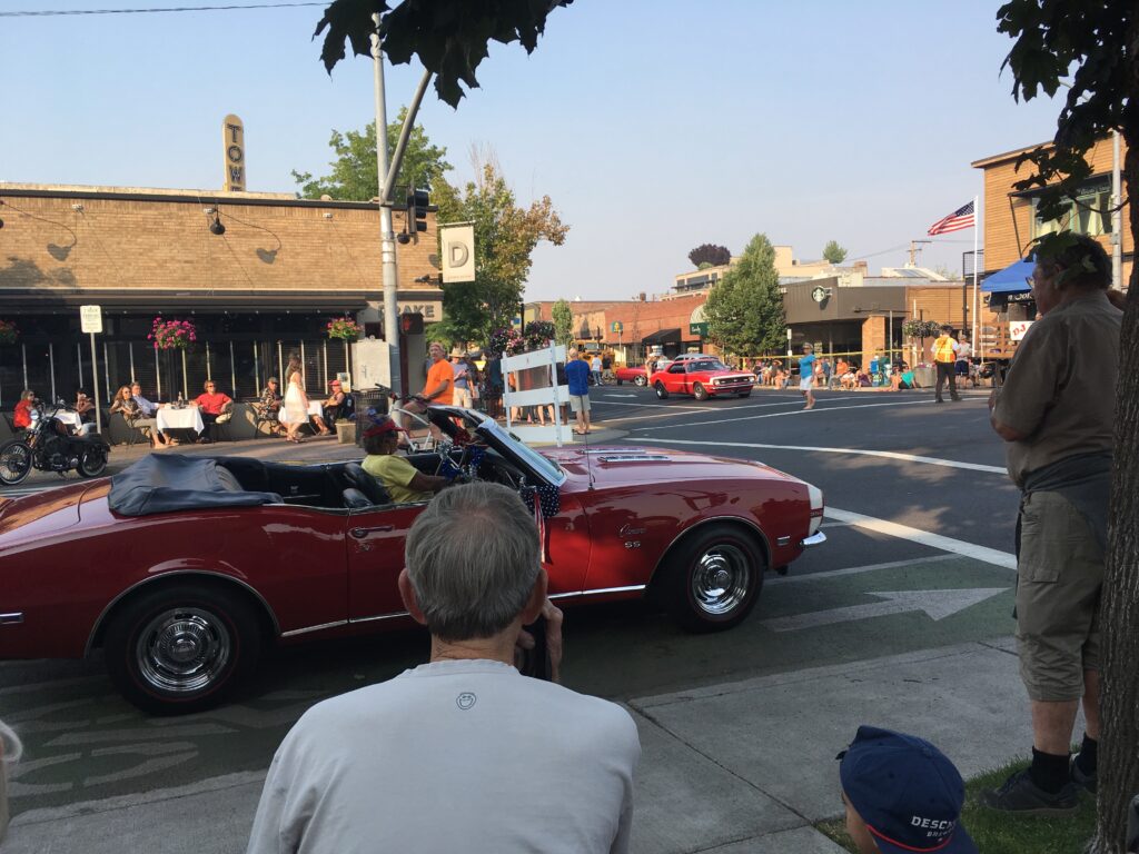
Sisters has taken ownership of the cowboy vibe and I reckon you have many opportunities to buy a pair of boots or a hat, especially if you want to get ready for the Sisters Rodeo, held the second weekend of June each year. This rodeo has been happening since 1940 and is dubbed, “The Biggest Little Show in the World”. Before you leave town, I recommend you stop and stretch your legs, maybe get a bite to eat, do some shopping, grab some homemade ice cream from the Sno Cap Drive In, or sip a latte at Sisters Coffee Company. This quaint town is thriving and I hope it stays that way!

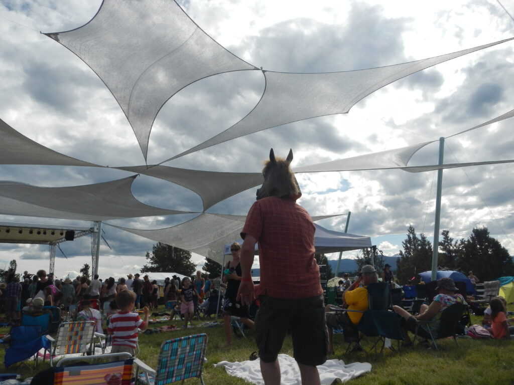
As we make our way east out of Sisters, I always feel the strong sense of community when I pass the fish art mural on the fence of Sisters Elementary School. It was created by students with the help of local artists and funded by the Sisters Folk Festival, a not for profit arts promotion organization that holds its folk music event the weekend after Labor Day every year. I also can’t let us leave Sisters without mentioning the Sisters Outdoor Quilt Show held every year the second Saturday in July. While the rodeo is called the biggest little show in the world, this is the world’s largest outdoor quilt show and sale with over 1300 quilts from around the world. For this annual event, this small community opens itself to over 10,000 visitors of all ages from all 50 states and over 25 countries, educating and sharing stories about the skill, the art, and the heritage of quilt making.
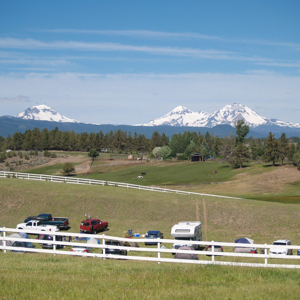
First view of Sisters
Now that we’re outside of Sisters, we quickly find ourselves in the wide open plains of the High Desert. We also get our first spectacular views of the mountains if it’s one of the 300-plus days of sunshine. Those three noticeable peaks were first referenced as “Faith, Hope, and Charity” by the early settlers. Today we know them as the South, Middle, and North Sister mountains, or collectively as “The Three Sisters”. The Native American tribes of this region had trails all through these areas. It wasn’t until the early 1800s that European and American explorers first took note of these mountains in their journals. One of the first was British trader and explorer Peter Skene Ogden who will play a major role in the stories of Central Oregon I will share in other Together Anywhere driving tours. Skene came across this view for the first time in 1825 and was followed closely by Scottish botanist David Douglas in 1826.

Sisters Rodeo
Since we don’t pass the location until we are outside of Sisters, I have some time to tell you a bit more about the Sisters Rodeo. While it used to be in the town proper, it is now housed outside of the city limits on the way to Bend. It all started in 1940 when professional and amateur cowboys began flocking to Sisters for the annual annual rodeo. The prize money of $500 was equal to the big rodeos of the day, found in places like Pendleton, Oregon and Cheyenne, Wyoming. That is how this came to be the “Biggest Little Show in the World.” Today, the Sisters Rodeo continues how it began: as a mostly all volunteer production and a staple of the Sisters community. With nearly 200 members, the rodeo association has also remained a valuable member of the Sisters community. If you plan to visit the Central Oregon region during the second week of June, be ready for some foot stomping, country music blaring, beer drinking, and rootin tootin good time.
Three Sisters Viewpoint
The viewpoint for the Sisters mountains is past the turnoff to the rodeo. The Three Sisters are each more than 10,000 feet in elevation and are the third-, fourth- and fifth-highest peaks in Oregon. The Sisters are actually volcanoes and part of what is known as the Pacific Ring of Fire. Middle and North Sister are likely dormant and have not erupted in over 14,000 years. South Sister, however, erupted just 2000 years ago and has shown signs that it may someday erupt again. The unobstructed view of the mountains also includes Broken Top, a 100,000 year old stratovolcano which appears “broken” because of glacial erosion. This is a great spot to take a photo however, my camera never does it justice. So I just stop and soak in the wonder.

Landscape and Bendistillery
As we start to acclimate to this High Desert climate, the landscape and pine trees are still changing since we’ve left the Western Cascades. I’ve told you about the Ponderosa pine and its drier climate survival, but when the pine stops dominating, the Western Juniper takes over. We also become familiar with the big sagebrush which is the most common plant in the High Desert region. There are also about 94 species of mammals found in this area but nearly half of them are rodents! You might also spot mule deer, coyote, or even a cougar. You can learn about all of these animals and even birds of prey at the High Desert Museum on Highway 97, a favorite stop of mine when I’m spending more time in the Bend area.
Another stop I like to make when I have time is the Bendistillery. If you are over 21, you can sample award-winning spirits made here like Crater Lake gin, rye whiskey, vodka, and vodka infusions. At this 24 acre campus, various grains are grown and harvested to be used in production.
Town of Tumalo
As the speed limit slows to 45, we are entering the small town of Tumalo. Three variations of the word Tumalo exist in Klamath Indian language, one meaning “wild plum” another as “ground fog” and the third “icy water” which surely is how Tumalo Creek got its name. Tumalo Creek joins the Deschutes river just before it goes through Tumalo State Park, which is one of the upcoming stops on this side trip. It’s all a bit confusing, I know. To make matters even more confusing, if you are looking for Tumalo Falls, Bend’s most notable waterfall, it’s not really anywhere close to the town of Tumalo as you have to head 15 minutes west of Bend to find this 97 foot drop on Tumalo Creek.
Side trip on O.B. Riley Road
As the turnoff starts you with driving through an industrial area, you may be wondering what kind of side trip is this? Well there is some historical significance worth mentioning. Central Oregon was settled nearly 50 years after the western part of Oregon. It wasn’t until the late 1800s that people began to establish homesteads in this area as the High Desert climate proved difficult for farming. The road we are driving on is named after one of the first white settlers in the area, Ovid W.B. Riley, who moved with his family to the Bend town site from Kansas in 1896. The Riley family had their homestead claim on the Deschutes in this area. Ovid later moved to Bend with his wife Alice and worked at the Shevlin-Hixon Lumber Company. The road’s name was originally Ovid W.B. Riley road and was eventually shortened to O.B. Riley Road. Ovid passed away in 1962 at the age of 87. If only Ovid could drive O.B. Riley road now… oh, the stories he could tell!

Tumalo State Park
In this great land of outdoor adventure opportunities, there are surprisingly few public camping sites other than the Deschutes National Forest. Tumalo State Park is close to the city for access to all of the area’s natural and commercial wonders and far enough away to allow for the feeling of getting away. It offers camping year round with 23 full-hookup sites, 54 tent sites and seven yurts with two even being pet friendly. There are some great hiking options along the Deschutes River Trail here with either a 4 mile or a 6.6 mile out and back with some small loops.
Deschutes River Canyon
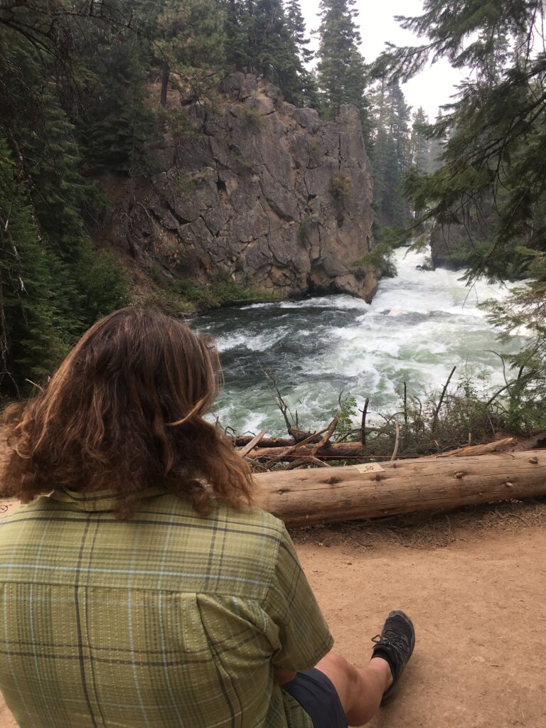
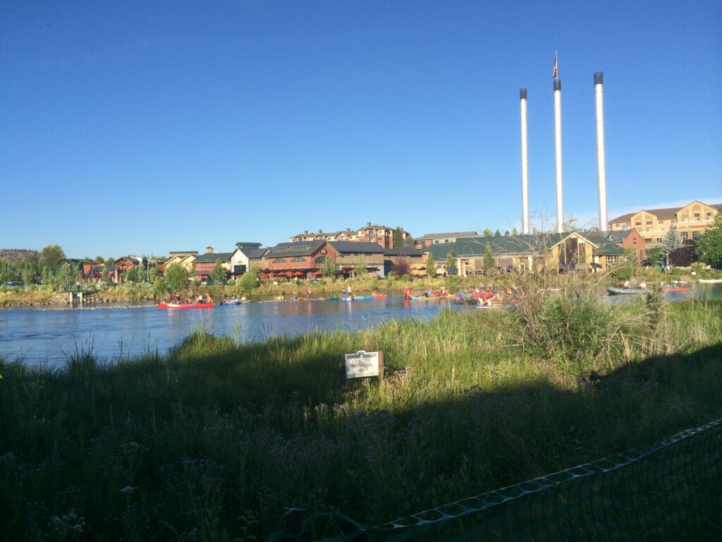
Leaving Tumalo State Park, you climb out of the canyon carved by the Deschutes River, the primary waterway that weaves its way through the city of Bend. Its headwaters emerge at Little Lava Lake in the Cascade Lakes area and then flows north for 250 miles until it merges with the Columbia River, 5 miles west of Biggs Junction. Along with the Willamette River, it is one of the few rivers that actually flows north. This river was an important route for the Native Americans, followed by the Oregon Trail settlers in the 19th century. The name Deschutes was given to the river because of the Celilo Falls that used to exist near the mouth of the river on the Columbia, now underwater due to the construction of dams. Today, the Deschutes is an important lifesource for Central Oregonians and provides for electricity, irrigation, fishing, beer, and recreational opportunities like tubing, kayaking, whitewater rafting, and the popular stand-up paddleboarding.

Riley Ranch Nature Reserve
On the right side of the road as your continue towards Bend is Riley Ranch Nature Reserve, a Bend City Park that opened as recently as December of 2017. Named after the Riley family settlers, this 184 acre reserve provides several hiking trails of varying levels of difficulty. The ranch is focused on conservation of the natural, cultural, and recreation resources found in Central Oregon and offers stunning views of the High Desert landscape, canyon overlooks carved by the Deschutes River, and views of the Three Sisters. Wayfinding signage is located near the parking area and directs you to the multiple trails, including one that is ADA accessible. By the way, this is the only Bend park that does not allow dogs or bicycles so plan accordingly if Sparky is along with you in the car.
Sawyer Park
If you are interested in taking a short hike with some amazing views, Sawyer Park (past Riley Ranch) is worth a stop. Here, you can walk alongside part of the Deschutes River and see the diversity of the landscape as the river drops into a steep canyon while you walk safely alongside the canyon wall. This trail is part of the greater Deschutes River Trail System and allows nearly uninterrupted access to the Deschutes River flowing right through the middle of Bend. You can explore over 15 miles of trail throughout town. Many more segments of the Deschutes River Trail continue on further into the Deschutes National Forest. Stop at a ranger station or go online to check out the multitude of options.
Entering Bend
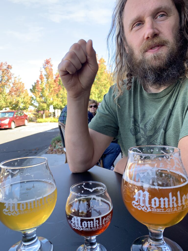
As O.B. Riley Road ends, we are back on Highway 20. Make sure you pass the exits up ahead and let’s continue straight. Even though the Deschutes River is less than 500 feet away, it is hidden by the hotels and the commercial growth that is required for cities that quadruple in size in just ten years. As we leave the land of wilderness and no stop lights, we have arrived in the land of outdoor shops and craft beer. Outdoor recreation and beer are a big deal in Bend. With over 20 micro-breweries, Bend has one of the highest per capita rates of microbreweries in the country. For a fun adventure, check out the Bend Ale Trail that winds you through the area and introduces you to the array of drinkable delights in Central Oregon.
To hit all the good spots, continue on Highway 20 under US Route 97, a major north-south highway that starts in Weed, California and becomes British Columbia Highway 97 as it enters Canada all the way up north! A special surprise is in store for you soon enough!
Blockbuster Video
That is right… the last one IN THE WORLD! Now brace yourself as I take us back into the wild, wild, world without internet. That’s right you post-millenials…what did we do without Netflix, Hulu, or even Instagram? We spent our weekends having spirited debates with our loved ones, deciding what to watch on the television. We did this at a place called Blockbuster Video. In fact, the last Blockbuster Video on the planet is right here, on the southwest corner of the next stoplight. Maybe after all this fun in Sisters, you’re in the mood for a good spaghetti western. Or, want to see where Sahalie Falls appears in Homeward Bound? At the very least, you could go in for a commemorative t-shirt or even a free membership card like they used to offer in the nineties. To finish the tour, make sure and keep following this road for just a bit longer…I will let you know when to make our turn towards downtown.
Just after Blockbuster, we will turn right and head into downtown Bend. If you look to your left, you can see an actual dormant volcano in the city limits known as Pilot Butte, one of only 4 places in the United States with a volcano in their city limits! You can hike or drive to the top of this 480 foot butte that offers 360 degree views of Central Oregon. If you want to visit, take a left at this light. However, my commentary will end for you at this point. If you are staying with me until the very end, turn right.
Downtown Bend
As you drive down Hawthorne and curve with it to the right, you will see the Visit Bend Visitor Center sitting at the corner of NW Lava Road and NW Oregon Avenue. As my tour has come to an end, you are now at the perfect place to start all of your Bend and Central Oregon adventures. They are open daily and provide free maps, guidebooks, and experts in all that this area has to offer.
Drop me a line and let me know what you would like to hear about next time. Happy adventuring and take us along with you next time by just downloading the app!
Where you can find our tours:
- Mount Hood Scenic Byway
- Columbia River Gorge National Scenic Area
- Mount Hood East and Hood River Fruit Loop
- Santiam-McKenzie Pass Scenic Byway
- McKenzie River Scenic Byway (recently updated)
- West Cascades Scenic Byway
- Sisters to Bend Highway 20
- Santiam Canyon Highway 22
